Fact: the bounds of our own capabilities are severely limited by our minds. In running, two specific occasions have served well to prove this fact to me; one being the first time I ran as a pacer at the Western States 100M where I planned to run 18 miles, but ended up running 46 (that was my first time running longer than the 26.2 mile marathon distance); the other being the 2014 Comrades Marathon in South Africa, where I was elated to have reached the finish line well ahead of the cutoff despite having missed the crux of my training due to injury. With this fact accepted and those experiences under my belt, I stood my grossly under-trained (by my standards) self alongside a wonderful group of runners at the start line of the 2015 Tamalpa Headlands 50k with a smile on my face.
I don't recommend running ultramarathons without proper training, but if you find yourself feeling confident enough to do so, by all means, take it easy out there! This was my third time running this race, so I'm very familiar with the course and my goals for the day were simply to enjoy the trails with friends and not get injured. My strategy to achieve that goal was to run slowly, hike often, and IF I found myself feeling peppy and un-hurt at mile 20, to run as "fast" as I wanted during the last 11 miles.
It just so happened that after 20 enjoyable miles, I was feeling un-hurt and peppy (arguably). So, I picked up the pace, slipping and sliding down the Matt Davis Trail to Stinson Beach. I grabbed a can of soda and dragged it up the ~1,500 ft. climb to the last aid station and hustled off to the finish. I was surprised to find that I managed to run my fastest split ever for the final 4 miles of the course (although my finish time was my slowest for the race). For the 20th time (7th this year), I crossed the finish line of an ultramarathon. It occurred with a smile on my face and no limp. Mission accomplished.
I'll have a medal, hat, shirt, buff, and some food, please.
A dozen 50k finishers! Had a blast camping pre/post race with my Folsom Trail Runner friends!
After a 4-5 hour drive, I was welcomed to the small town of Mt. Shasta by majestic views of the mountain. I checked in to the Best Western, which was not the cheapest place around but was really nice and served as great place to hang the helmet before and after a long adventurous day. To my delight, I quickly located some tasty vegan food at a nearby Thai food restaurant (Andaman Healthy Thai Cuisine), nestled among the restaurants and shops of the quaint little downtown strip. I topped off my belly, walked back to my room, set my alarm for a 2:45 AM wake-up, and got lazy... dozing off around 8 PM.
I awoke, ate a couple bananas and a couple bowls of oatmeal, picked up my gear pile, and loaded us into my truck. The anticipated 45-50 minute drive to the Clear Creek Trail Head ended up taking me closer to two hours. The dirt road to the trail head was described to be fairly easily accessible by 2WD, low clearance vehicles, but my experience was that 4x4 was necessary (I got my truck stuck while in 2WD, but quickly loosed it by switching to 4WD). I thought I had made a wrong turn once or twice and did some doubling back, but eventually made my way to the trail head. I later found that 2 days prior, significant flash flooding, induced by intense thunderstorms and downpours at elevations nearing the summit, had washed out many portions of the road, creating numerous soft spots and opening up gullies. I'm thankful for my truck or else the road conditions may have derailed my summit attempt before it began! According to the 08/23/2015 update on ShastaAvalanch.org, the road in has been repaired and is on it's way to being 2WD friendly again.
My trek began at 5 AM on the dot, an hour later than planned. I set out on the trail, which was well-defined and easy to follow, despite having been ravaged by flash flooding only days earlier (something I wasn't aware of at the start, but was clearly visible in the daylight during my return). My head lamp showed me the way and I went.
Early morning at the onset of the Clear Creek Route
Within the hour, a glow from the east began to illuminate my surroundings. I stuffed my headlamp into my pack. The sunrise was a memorable one, burning through the smoke and haze of the valley; prompting the trees to reach up into the light, to stretch out their long shadows as if awakening from a nap; and painting Mt. Shasta, the behemoth, in pink and golden alpenglow.
Excellent performance by the rising sun.
As the sun rose, I hiked on, making a fairly good clip along the route, climbing steadily at a ~10-15% grade along a ridge that parallels and is northeast of the washout canyon below the Mud Creek and Konwakiton glaciers. Normally I would consider this a fairly steep incline. Today it was gentle and seemingly flat, compared to what lied ahead.
I've got a summit pass and I'm not afraid to use it!
Looking into Mud Creek Canyon. Mud Creek Falls could be heard, but barely seen in the distance.
After 3 miles and a little over an hour of hiking, I arrived at the Clear Creek crossing, a popular sleep over site for multi-day climbers, that roughly marks the end of the tree-line. It also marked the transition to the second of what I found to be three types of terrain and climbing (pedestrian, steep, and "oh shit"). As the tree and plant life receded, so did the soil. The route grew increasingly steep (10-15% slopes extended to 20-40% inclinations) and now consisted exclusively of volcanic ash/sand and rock. I chatted with a couple of multi-day climbers, who had summited the day prior, about conditions above and continued on. I was not equipped with a full set of traditional mountaineering gear and was greeted with odd stares (is this guy crazy?) from the guy I spoke with. He suggested I looked fit, unburdened by the weight of excessive gear, and wished me luck.
Clear Creek, far below the headwall of the upper route.
Looking down from above Clear Creek.
Advancing beyond Clear Creek, the sheer mass of the mountain began to show itself. The steep and endlessly expansive fields of scree that rise inexhaustibly up towards the sky are marked only by the scars of vast, unstable canyons, and eruptions of crumbling cliffs and spires. Aside from looking down on the forest, where the mighty pines, some 200 ft. tall, became indiscernible specs among the vast landscape, the only landmarks by which to measure progress, were Thumb Rock, which jutted up from the western ridge of Mud Creek Canyon and the ever-present head wall, high above me on the route.
The forest shrinking away into the distance.
Add caption
The head wall high above was a familiar sight throughout the day.
First sign of clouds, and some hiker friends from Santa Cruz.
Thumb Rock and the eastern side of The Red Banks
The head wall was getting closer, or was it?
As I moved past 10,000 ft., my pace had slowed, but my spirits were high and I was feeling great. My ~20 minute mile pace had become a 60-90 minute mile pace. The air was getting thinner, the scree was getting looser, and the route was becoming steeper. I was gaining 1,000 to 1,600 ft per mile now.
At 10,000-11,000 ft, I passed a set of four climbers who had started from their camp at Clear Creek in the morning. We exchanged a few words and I trudged on past them. I kept looking back at them, noting their progress and noticed that one couple was moving significantly better and faster than the other two. I later learned that the slower pair of the group turned back without making the summit. For the next couple of hours, I would climb, stepping slowly and occasionally stop to rest and snack on Pro Bars and drink water. The faster couple from the foursome I passed, who were from Santa Cruz, would catch up to within ear shot, we would talk for a bit and then I would go ahead.
Finally I saw Mushroom Rock coming into view, a landmark of the route, sitting around 12,500 ft. The climb beyond this point became more treacherous due to the extremely loose rock and ever increasing incline of the route. I strapped on my helmet and pressed on. I encountered a guy coming down who had made it to about 13,800 ft, but while experiencing dizziness and nausea decided to turn back. Thankfully, while I wouldn't have complained if an oxygen bar was around, I was feeling no adverse effects from the altitude. My legs felt good, no headache, no nausea, I had been eating and drinking a lot and still had plenty of water. The weather was pleasant. I was comfortable in my short sleeved Comrades tech-t and Kuhl shorts, with the zip-off legs zipped off. I had several layers, including a puffy synthetic down jacket in my pack.
Mushroom Rock, ~12,500 ft.
Beyond Mushroom Rock came the third type of terrain I would encounter. The "Oh Shit" variety. Any signs of a trail dissipated quickly and I was left to my own judgement as to which would be the safest and best route to get me beyond the head wall that had loomed above me like some giant and distant guardian of the summit all day. The route now provided 20%-40% slopes with extremely loose rock and scree. Dislodging rocks that would tumble and crackle down the mountain was nearly unavoidable. I occasionally used all fours to climb and scramble up the mountain and before long came to the point where retrospectively, I clearly made a mistake. I chose a route that I was ill-equipped to navigate and subjected my life on an unacceptable level of risk. More on that in a sec.
Navigating past the head wall, above Mushroom Rock.
Most of this section felt much more like climbing than hiking.
Gaining more and more elevation and progressing towards the summit plateau, the northwestern edge of the Wintun Glacier at my right.
The next two photos show the area I ventured into and SHOULD NOT have. I would have liked to have captured a few more photos in between these two, but I was busy clinging, with all my might, to what felt like a nearly vertical icy, snow field with thousands of feet of exposure above the Wintun Glacier.
As I was climbing the scree, I had been avoiding some steep and treacherous looking (due to looseness and instability of the rock) chutes by drifting towards the east, my right. Eventually, I found myself at a point where the immediate choices presented to me (other choices existed but would have required backtracking and re-evaluating my previous route choices). My first choice was to wrestle my way up through a chute that looked like scaling a 40-50 ft wall. The second choice was to skirt around the large rocky outcropping in front of me by going out on to a snowfield. I approached the edge of the snowfield, and kicked my feet into it to test the consistency. The snow was soft and my feet dug in nicely. I looked up and down the slope, to where I wanted to be, and to where I would end up if I lost attachment to the snow and slid down. I evaluated the fall line (the line a rock, or ball, or body would take if dropped and allowed to free fall) of my planned route. At the entry point, I determined a worst case loss of grip would result in a harmless, maybe even enjoyable 20-30 ft slide down to a rocky area where I could easily re-evaluate my approach if needed. From my vantage point, I couldn't see all the way around the rocky pillar I wanted to bypass, but it looked like I would be able to stay close to the rock and kind of hug the edge of the snowfield, exiting at a point beyond the rocky chute I wanted to avoid climbing.
I'll mention that I left my crampons in the car because I knew from the research I had done they wouldn't be needed on this route. It was true that they weren't needed on the route, unless one had decided to wander out onto any part of a glacier (in my opinion). A route to the top, completely absent of snow (less crossing a ~50 ft patch of FLAT, snow, with NO exposure) was available to me, I just failed to recognize it.
Top-left shows the snowfield route I took to get around the rocky outcropping on the left
Anyway, my choice was the second and I feel that was a huge mistake. I readied my ice axe, kicked my feet into the snow and began climbing. I quickly covered some ground. It seemed easy and safe. Until almost instantaneously, it seemed neither easy nor safe. The slope and contour of the mountain forced me further onto the snowfield than I had anticipated. I looked back and down and realized that the fall line I was exposed to had changed completely. The rocky area that I thought I would be able to slide to was far to the left below me and the current fall line would have sent me plummeting into the heart of the Wintun Glacier and barring self-arrest, into the clouds below, and off of a cliff.
The consistency of the snow had changed. It was crusted with ice and no longer easy to kick strong foot holds into. I paused. Again, I evaluated where I was and what the best way to get to where I needed to go was. At this point, it felt safer to continue up the snowfield than to try to down-climb back to where I had left the rock. So I continued on. I'm not sure how steep the slope was, but it must have been more than a 50% grade (my GPS shows some 40-50% grades, but had trouble tracking elevation above 13,000 ft for some reason). It was becoming harder and harder to maintain a hold on the slope. I dug in my axe, keeping a firm hold with it close to my chest. I kicked in toe holds has best I could and I inched my way up.
I saw a potential exit point to my left and worked my way over to the edge of the snow field, my hold on the snow tenuous. As I got closer to the rock, I found that the snow gave way to patches of solid ice, 2-3 ft wide. There was no way I could cross the ice, so I inched back onto the snowfield and creeped further, beyond the ice. It had become so difficult to maintain my position on the snow at this point. Gravity and friction were working together and yearned for me to slide. I reached an area where I was close enough to stretch out my left arm to grab a piece of rock. The rock pulled loose with almost no resistance. The rock was too unstable here and I was forced to climb higher still. At this point, my mind wanted to panic. I thought of my family and my unborn son and felt I guilty for having put myself in this situation. Losing my grip WAS NOT an option. I firmed my hold with my axe, I jammed my fingers into the ice-crusted snow and bloodied my knees, slamming them against the slope, trying to make holds with any body part I had available in an effort to create as much friction with the slope as I could.
Eventually, through a good bit of worry and effort, I reached a stretch of stable rock. I clung to it like a castaway on the open seas would cling to dry land. I pulled and crawled myself off of the snow, climbed further up some scree and took a short rest.
Looking down on the snowfield I should never have set foot on. An un-arrested fall on that ice/snow would send one to the clouds.
A different angle of the top of the Wintun Glacier, the small trek onto the snowfield I took cannot be seen here.
GOOD NEWS!!! I had gained close to 7,000 vertical feet from the trailhead. I was above 13,000 ft and only had another mile and 1,200 more vertical feet to climb. After some more steep climbing, I was rewarded with some amazing views of the snowfields on the summit plateau, the glaciers of the west and north facing slopes, and the actual summit. The wind picked up on the summit plateau brought an icy cold upon me. I snatched my puffy jacket and buff and was snug... as a bug... in a rug.
BAD NEWS!!! The actual summit looked like a fortress that had been designed specifically to keep me off of it. I gazed up the tower of loose rock, which resembled a turreted castle tower and wondered if the intended route went straight up (based on what I had encountered thus far, I would not have been surprised). I briefly contemplated turning back, figuring I had experienced enough risk for the day.
I knew that there was a snowfield on the summit plateau that I needed to cross before gaining the summit and I had not done that yet. So I figured I'd go find that snowfield, hoping that a more obvious route would materialize along the way.
The upper reaches of the West-northwest facing Whitney Glacier.
My first clear view of the true summit... things seem not to be getting easier.
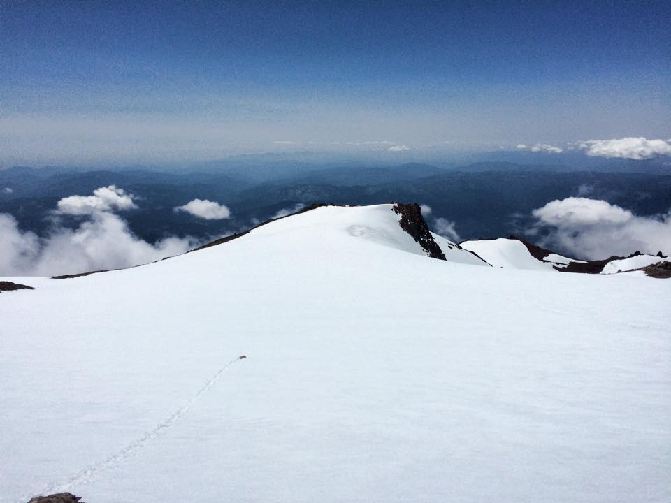
Expansive snowfield at ~13,500 ft
The first I saw of the summit was its south face. After quickly assessing the advanced skillset that would be required to gain the summit by climbing the south face, I trekked on northward, along the wu-EST Siiiiiiiiieeede of the summit spire. I crossed the snow field I had heard of and continually looked up towards the summit, probing the fortress tower for weaknesses. Soon enough, I found a soft spot in the underbelly of the beast, pictured here:
All that remained between the summit and I was this nearly vertical wall of rock and ice.
I saw a chute that looked navigable. I decided to leave my pack, bringing with me only the clothes on my back, helmet on my head, ice axe, and a Pro Bar for the summit. I hung a sharp right and charged upward. I was happy to find that the scree in the chute was packed in quite firmly. I carefully chose my hand and foot holds, but never felt any that were unstable. I snapped some shots on the way up.
Looking west, down my summit chute and towards Whitney Glacier.
Further up the chute. A mildly bloodied knee from my Wintun Glacier outing.
My summit chute selfie! Almost there!
Pano, taken ~80% of the way up the chute.
Mmmmade it! After 7-8 hours and 7,800 feet of vertical gain in 7 miles, I was standing on the 14,179 ft summit of Mt. Shasta and thumbing through the climber's log. Picture picture picture Note: an ice axe makes for a suitable selfie-stick, if you find yourself with a desperate need.
Summit box!
Easy
Summit pano
Summit selfie! I'd like to thank Edelrid for helping to make this trip possible by selling me a helmet at the full MSRP.
Looking down of the summit towards the southeast.
Sooooooooooo... who's still with me??? I spent 20-30 minutes on the summit, it was time to climb back down. One hilarious thing I forgot to mention, is that shortly after I wrangled my way up that chimney chute to the summit, I noticed that there was essentially a proper trail that looped around the northwest portion of the summit spire. Rather than downclimbing the rocky laundry chute, I basically jogged down the back side of the summit, made my way back to my pack, and headed back off the summit plateau.
About a half hour into my descent, I came across the couple from Santa Cruz that I had spoken with earlier. They had just made their way past the head wall and above the Wintun Glacier. Right away, I noticed that they were visibly shaken and soon found out that they had followed my tracks out onto the glacier and had a similarly harrowing experience while on it. They wore crampons for it and were shocked that I made it through without them. They urged me not to return the way I had come (even though I assured them that I would not go back out on the glacier), saying that there was no safe way there. They told me that it had been suggested to them to come down by traversing above the headwall, to the west, and then traversing back to the east beneath it, until arriving back at Mushroom Rock. I knew that this suggestion would take me towards Konwakiton and Mud Creek Glaciers and have me traverse above Mud Creek Canyon, which is a very dangerous place (due to severely unstable rock and cliff areas).
As I traversed across the scree above the head wall, I came to a point where I had to make another big decision. The options before me were to head down into a canyon/chute at the edge of the headwall or to traverse further to my right, which would certainly take me all the way around the headwall, but maybe too deep into glacial areas or Mud Creek Canyon. I worried that route into the large chute would lead to a cliff area and that the steep, loose scree slope might prevent me from backtracking, leaving me in a very bad situation.
This time I absolutely made the correct decision. I decided to follow the route that I could keep visual contact with. It led me down past the headwall, at which point I began my traverse back towards Mushroom Rock. The traverse was evenhandedly dicey, covering a half mile across a 40% graded slope of the loosest scree and rock I had encountered all day.
It was very clear that the slope below me dropped off into oblivion, so I kept as much elevation as possible during the traverse. Occasionally I would slide 5-10 ft, being carried by bed of rolling, ball bearing like rocks. I sent numerous 25-50 lb boulders crashing down the mountain. I yelled out in warning even though I was certain nobody was down there.
Making my way down the southwest edge of the headwall. Konwakiton Glacier on the right. Mud Creek Glacier/Canyon center and left.
Making the traverse below the headwall, above Mud Creek Canyon.
Doing my best not to fall down there.
Looking back up at the chute/canyon I considered downclimbing... that would have been a crappy decision.
An hour and twenty minutes after the couple from Santa Cruz urged me to take a different route, I had made it back to Mushroom Rock! From here on out, there would be a trail and the world was safe. Cruisin' down the street in my 6 4... uh, I mean cruising down the scree was like a game and I was happy to be playing. I would run for a few hundred yards, stop to pour a couple of pounds of gravel out of my shoes, run a few hundred more yards, and so on. Before long, the mighty pines that had dwindled away long ago were visible again, they grew and they grew. Thumb Rock was back and the headwall once more became an unattainable monolith, high above and behind me.
Thumb Rock & Mud Creek Glacier
The headwall back where it belongs, towering high above me.
Gaiters would have come in handy here. Shoe dump every 5 minutes.
I began to encounter groups of multi-day climbers who were heading above the tree line to make camp for the night. They asked if I had made it and offered congratulations when I said yes. The krummholz trees and Clear Creek came back into my life and they brought with them silky smooth and gentle trail. Trail running trail. I ran gently back to the trailhead, stopping to chat with multi-day climbers who were making their way to their camps. My journey lasted just over 13 hours and aside from the one bad decision I made, I was really happy with the day and I'm glad to carry the experience with me. I've spent quite a bit if time thinking about my hair-raising experience on the snowfield. Was I really in as much danger as I had recognized in the moment? I likely could have self-arrested any fall, but then would have found myself farther out on the glacier, without crampons and minimal experience climbing steep snow slopes. Regardless of what the actual risk factor was, as opposed to the perceived factor, in a primal sense, I recall a few of those moments to be among, if not the, scariest moments of my life and that alone suggests the risk was real and higher than is acceptable for me. I should have been with someone more familiar with the mountain, who could have identified and avoided the situation, but as it stands, I'm just happy to have learned a lesson... that I did not have to pay for.
Evidence of the flash floods from a few days earlier was everywhere.
OK, truck. Let's go.
I made it back to my hotel in about an hour and drank 5 svelte protein drinks along the way. I was thankful that the mountain let me come back to enjoy more things. I had a fantastic nights sleep.
On my drive home the next day, I decided to swing by Lassen National Park and summit the 10,463 ft Lassen Peak. That was fun and only took 90 minutes!
Some Links for those interested in climbing the route:


